I had a friend in town for Thanksgiving. She has been to San Francisco many times before, so we have done all the obvious touristy things in town and even day trips like wine tasting in Napa. When I asked her if she had any requests for this visit, she wanted to see redwood trees near Muir Woods. I knew an epic Mount Tamalpais hike near Stinson Beach to take her on including a late lunch as a British Inn and ending with the sunset at Muir Beach.
This Mount Tamalpais hike trail has it all, meadows with ocean views, bridges crossing small creeks, a ladder next to a waterfall, and towering redwood trees. It is not an easy hike, but as long as you can handle 6 miles with breaks and snacks, it is doable.
Route Summary
This Mount Tamalpais hike route starts near Stinson Beach and heads up hill. You will pass through coastal oak trees, and a meadow with views of the Pacific. A little over halfway in you arrive at Pantoll Ranger Station with a chance to use a bathroom and refill water bottle before heading downhill through redwood trees along a creek. You even have to climb down a wood ladder next to a small waterfall! At the end, you are rewarded with more ocean views as you descend back to the start at Stinson Beach.
The finale is a short drive along the coast before you feast at a small British Inn before watching the sunset at Muir Beach. If you feel the need to check out Muir Woods, the parking lot and visitor center is close to Pelican Inn and is included on the map.
Read on for the full itinerary and access the map of all locations mentioned in this Mount Tamalpais hike post.

Itinerary Summary
The Hike
Matt Davis Trail to Streep Ravine Trail to Dipsea Trail
- Distance: 6.4 miles
- Elevation Gain: 1,719 ft
- Time: 3.5 hours
After the hike…
- Late Lunch at Pelican Inn
- Sunset at Muir Beach
Tips
- Pack water and snacks for the hike, you can refill water halfway through
- The trail can be slippery, make sure you wear good hiking shoes
- Dress in layers. It can start out cooler and become warmer in areas where you are exposed to the sun in the meadows
- No dogs are allowed on this route
Map of Landmarks
Note: Google will not let me show a walking route on the Steep Ravine Trail, so only landmarks are on the map. For a trail map, there is more information on All Trails.
The Full Itinerary
We did this over Thanksgiving weekend, so the sunset was around 5pm and we wanted to be heading back to San Francisco before dark. If you do this hike in the summer, you will have more time for daylight.
We ate breakfast at home and headed to Marin around 9:30am to make it to the trailhead around 10:30am.

Parking
Park near Stinson Beach. The parking location is shown on the map. There are only a few parking spaces there. If it is full, you can park in the neighborhood near the Fire Station. Wherever you park, you will walk towards the fire station to find the start of the trail.

Matt Davis Trail
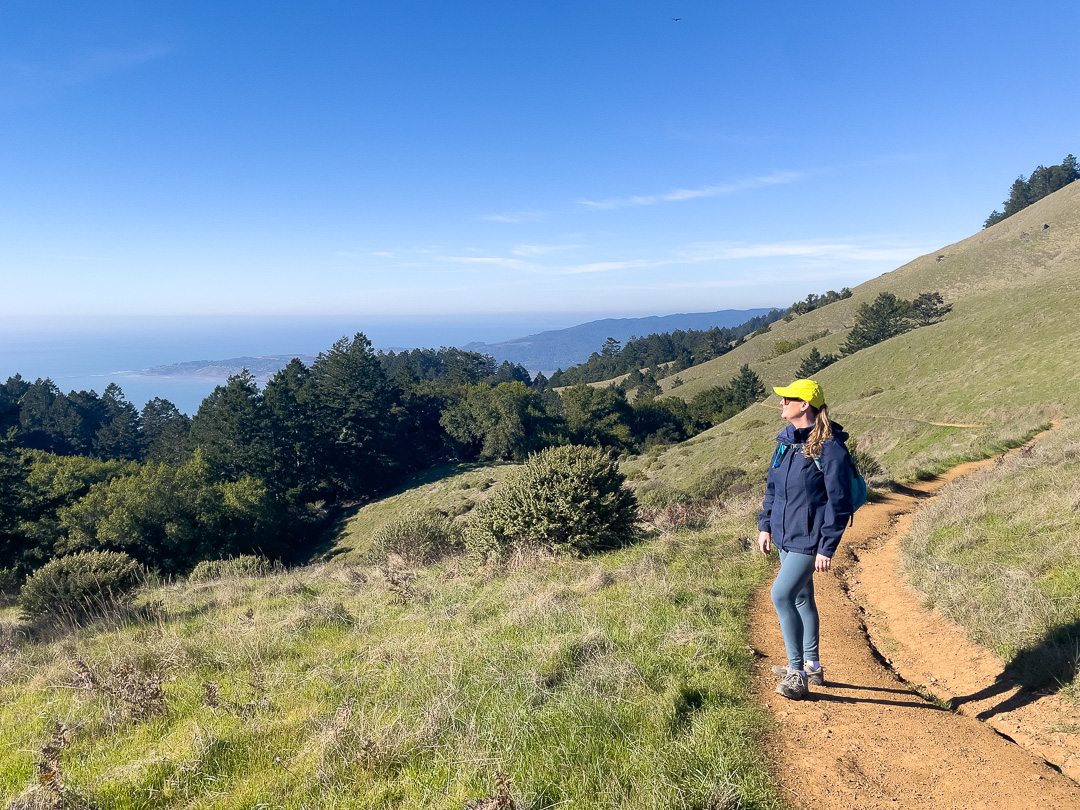
The trail begins just behind the Fire Station. I like to start heading up the Matt Davis trail. You start uphill, climbing through coastal oak trees. Starting uphill is my favorite because it means you do the hardest work at the beginning to be rewarded with the best views and heading downhill at the end.
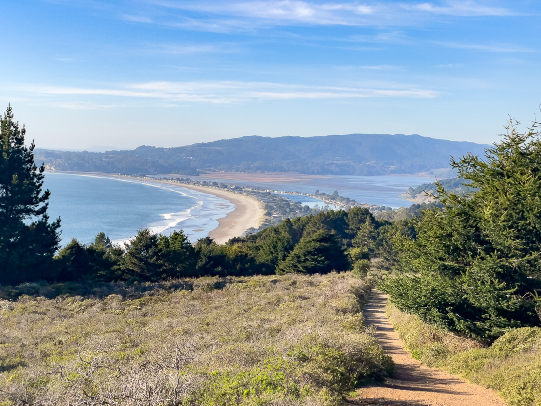
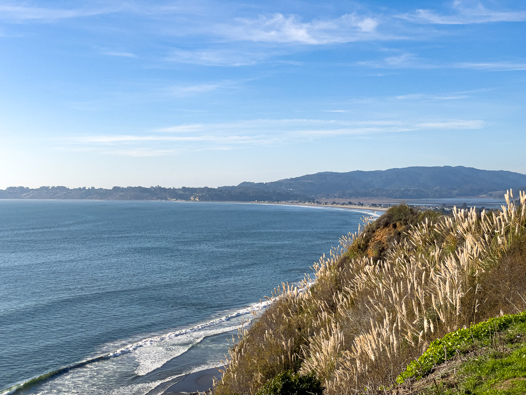
Once you reach the top, the trail opens up into a meadow with views down to the Pacific Ocean and fir trees below.
Pantoll Campground and Ranger Station
A little over halfway, you cross Panoramic Highway (don’t worry, it is just a 2-lane road) and reach Pantoll Campground. There is a ranger station here with trail maps, bathrooms, and a water fountain in case you need to refill your water bottle.
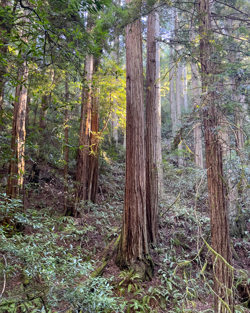
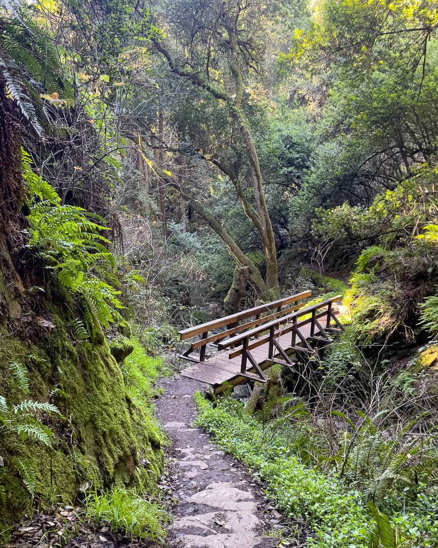
Steep Ravine Trail
Next, head downhill on the Steep Ravine Trail. There are trail head signs from the campground. This is one of my favorite trails. It leads downhill along a creek through redwood trees and ferns. The waterflow fluctuates greatly depending on how much rain has occurred recently. Even in drier times, there are some slippery spots so make sure you are wearing good hiking shoes.
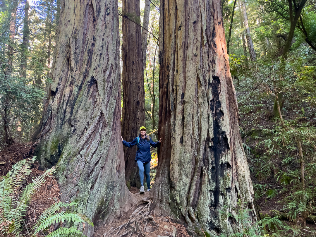
Highlights of this part are a pair of giant redwoods you walk between, a wood ladder next to a small waterfalls, and of course all the redwoods.
Dipsea Trail
Watch the trailhead signs. Once you get closer to the bottom, the trail splits at the Dipsea Trail. Take a slight right onto the Dipsea Trail towards Stinson Beach (downhill). This leads you back to Stinson beach and you are rewarded with ocean views on your way down.

Highway 1
If you have time once you reach your car, you can take a short detour to check out Stinson Beach, or head south to Pelican Inn. This 15-minute drive along highway way 1 is stunning and there are a few places to pull over for a photo if you want to take a minute to appreciate the views.
Pelican Inn
Pelican Inn is a British Inn and Pub near Muir Beach. They don’t take reservations so you may have to wait if it is a busy weekend, but it is worth it and you can enjoy a Guinness on the lawn while you wait. Expect traditional British food like bangers and mash and fish and chips. To drink, I love the back velvet, half Guiness and half cider!

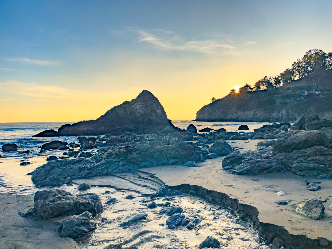
Muir Beach Sunset
After your meal, it is a short drive to park at Muir Beach and a short walk to make it to the beach. Enjoy the view, and hopefully a sunset before heading back to San Francisco.
Back to San Francisco
I hope you enjoyed this hike. If you have other favorite hikes in the area let me know.
Leave a Reply