There’s no better way to understand San Francisco’s layered topography than by walking it. This route begins in Noe Valley, one of the city’s most charming residential neighborhoods, and winds upward through a sequence of hidden stairways and hillside streets to walk to Twin Peaks, one of the best panoramic viewpoints in San Francisco.
As an architect, I love this walk because it’s not only a workout but it passes from the rigid grid that most of San Francisco was designed with to the winding streets that follow the topography as you get closer to Twin Peaks.
Overview
Distance: ~2.5 miles round-trip
Elevation gain: ~700 feet
Estimated walking time: 1.5 – 2 hours at a leisurely pace
Difficulty: Moderate (steep stairways and grades)
Highlights: Hidden stairways, terraced gardens, panoramic city views
The Route: Noe Valley to Twin Peaks
My favorite route takes the long and scenic way up and the fast way down several stairways. Sometimes I do it in reverse if I really want to feel the burn on the way up. From the cafés of Noe Valley’s 24th Street to the stairs of Twin Peaks, the route climbs steadily through residential blocks and public stairs.
This loop follows the stops in order from your mapped route. They are labeled with letters that match the map with some optional stops in case you want a longer hike.
A. Subs Inc.
A classic neighborhood sandwich shop on 24th Street. They also sell scoops of Mitchel’s Ice Cream. Pick up a sandwich to eat at the top, or save this stop for the end. The final stop is at a bar that allows you to bring in outside food if you pref to eat post-hike.
Once you have food, head up the hill on Castro Street to 23rd Street, and head north on Douglass Street. You will be treated to views of the adorable homes in Noe Valley along the way.
B. Neighbor’s Corner
If you are in need of caffeine, Neighbor’s Corner is a quaint café along the way, and one of the last businesses you will pass for a while. The last block of Douglass has many adorable homes as you continue on.
The next stop at the Corwin Street Community Gardens and Stair is optional before you head up the hill on Romaine.
Optional – Corwin Street Community Garden and Stairs
This is an optional stop to see the small public stairway with gardens and a surprise view towards Downtown.
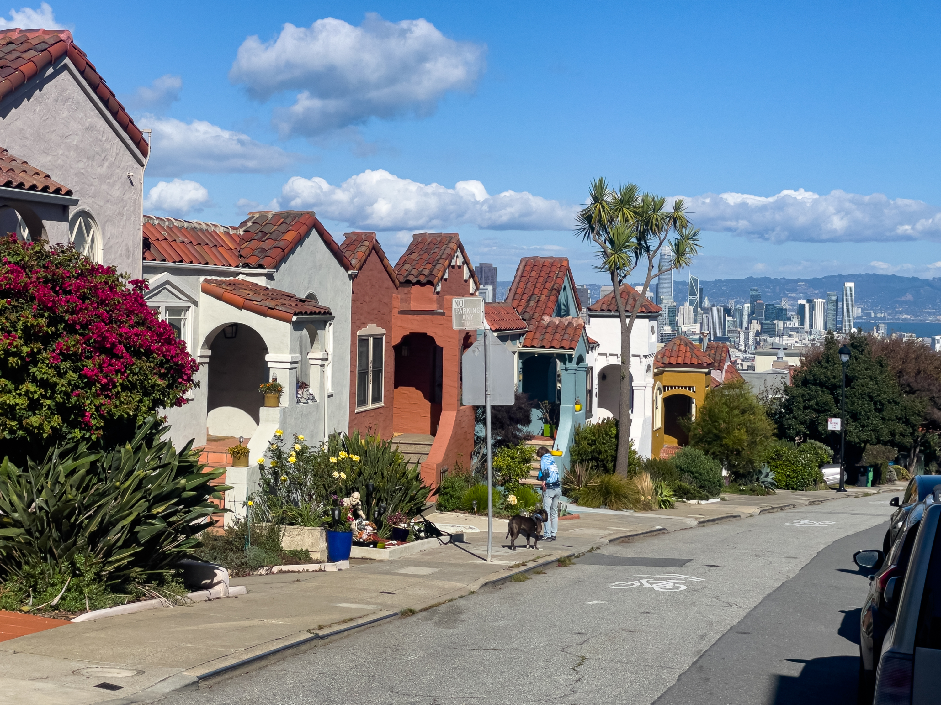
C. Romaine Street
To Cross Market Street, head up the spiral ramp and cross the bridge. On the other side, make sure the admire the colorful bungalows, the perfectly framed view of Sutro Tower above, and the view of Downtown behind you.
At the end of Romaine, turn right onto Corbett Street. The map shows staying on Corbet to the bottom of the Pemberton Place Stairs. If you need a shortcut, head up Greystone Terrace to skip the lower part of the stairs.
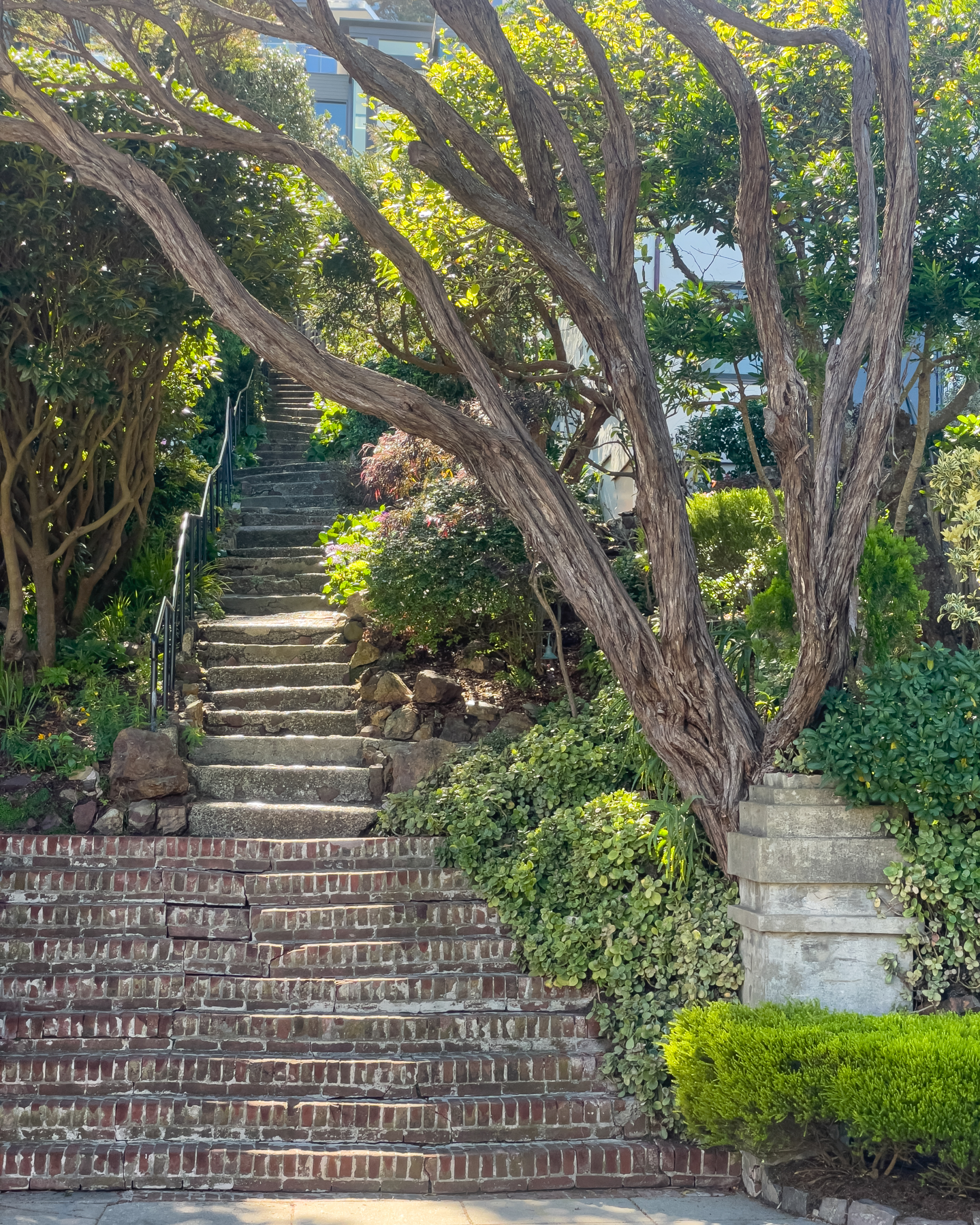
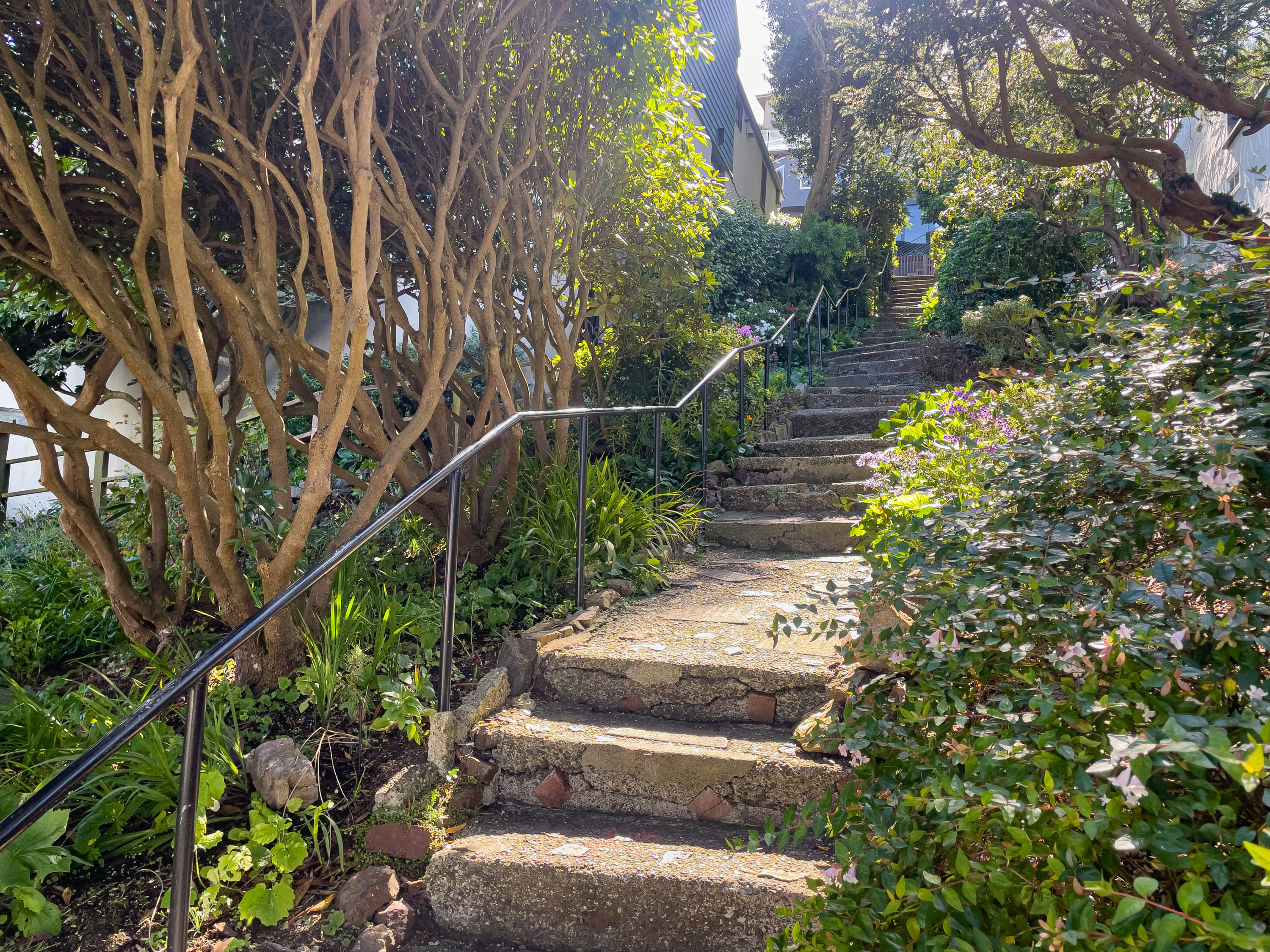
D. Pemberton Place Steps
One of the highlights of the route is this long stairway between residential homes with gardens all the way up. Don’t forget to look behind you, there are perfectly framed Downtown views between the gardens and even an arbor you will pass under along the way.
At the top, turn right onto Crown Terrace.
Optional – Tank Hill Park
This is an optional stop if you want to check out the view before heading up to Twin Peaks.
Either way, you will head up Clarendon for a short distance before turning left onto Twin Peaks Boulevard. As you head up the hill you will start to see views of the Golden Gate Bridge and Downtown.
Optional – Twin Peaks Christmas Tree Point
Optional stop at the panoramic viewpoint. I have this as optional because although this is an amazing view, it is in the parking lot along with many other visitors. There is also a public toilet if you need it. I love coming over here during Pride month when the giant pink triangle is on display, but I prefer the top of the peaks more.
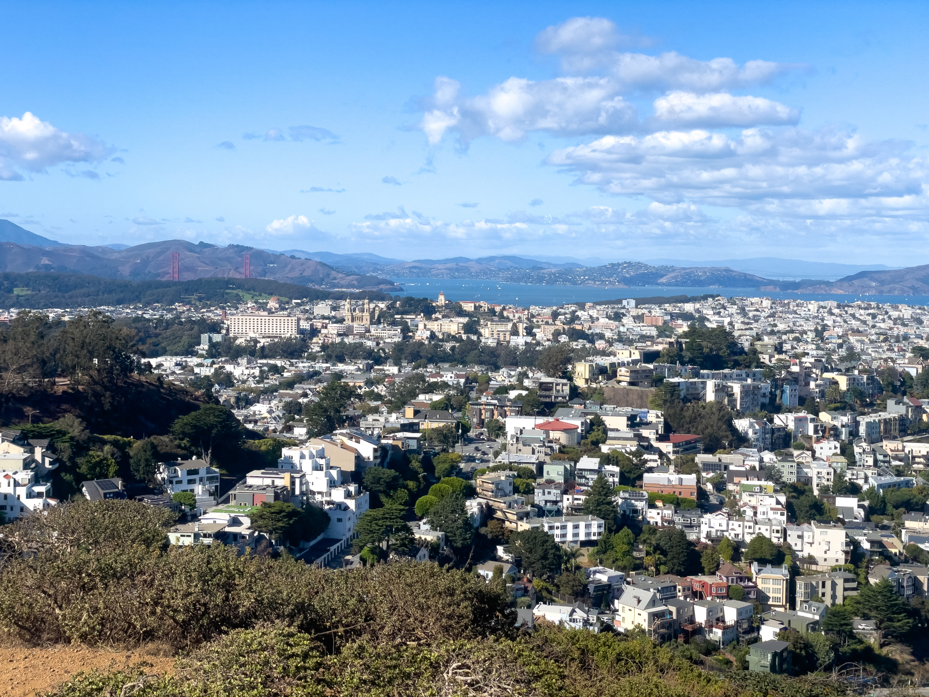
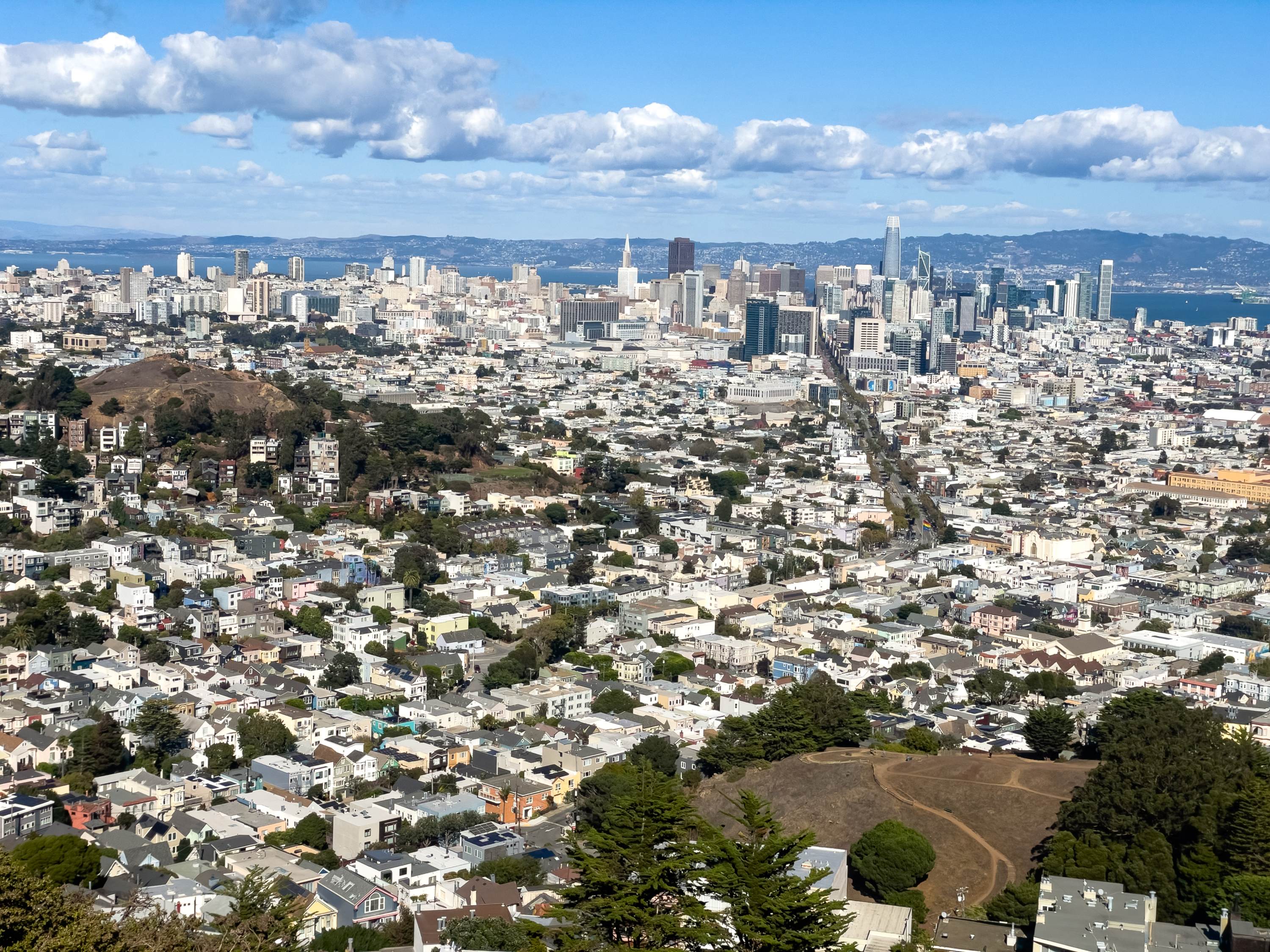
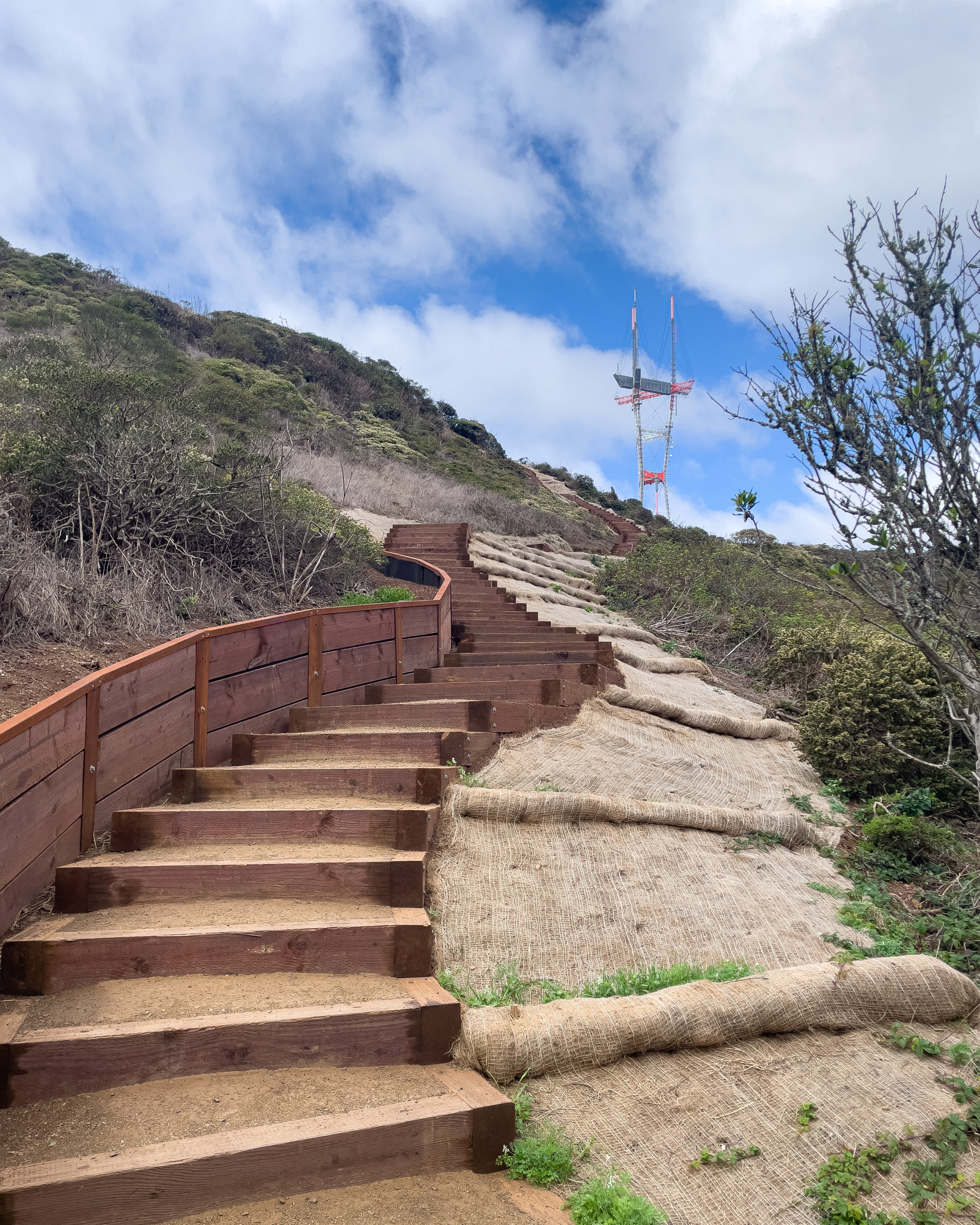
E. Eureka Peak (Panoramic Views at Twin Peaks)
The stairs to each of the peaks have been redone recently and these are the final stairs to the top. From here, you have a complete panoramic view of San Francisco. On a clear day you can see Mount Diablo in the Easy Bay, the Pacific Ocean to the West, and San Francisco below you.
It is often windy up here so be prepared to hold onto your hats.

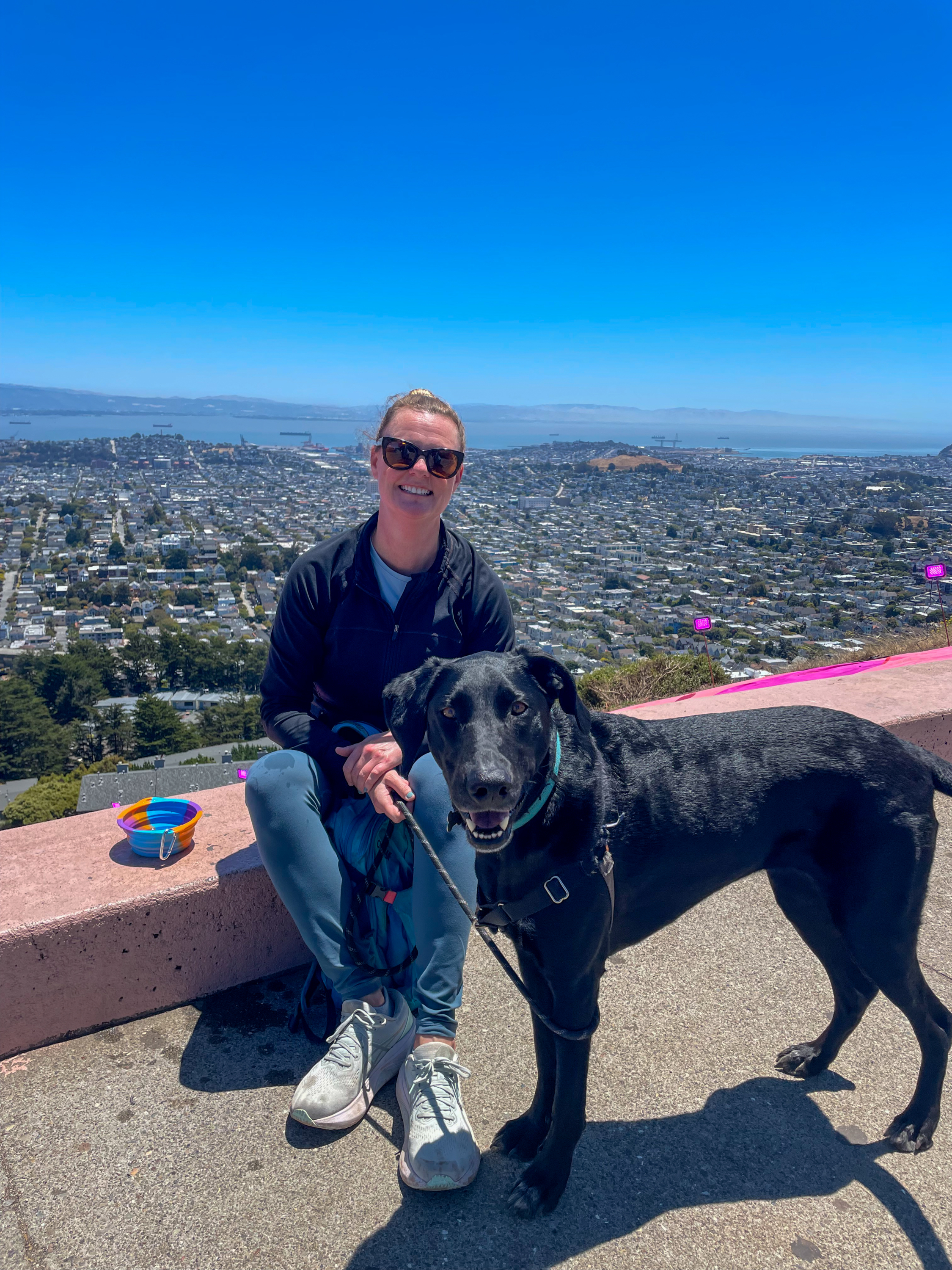
F. Noe Peak (Twin Peaks Summit)
If you are up for it, head to the top of the second peak, this one is actually my favorite.
If you decide to eat at the top, I like to stop and take a break at the top of the peaks (if it isn’t too windy) or sit on the barriers at the edge of Twin Peaks Boulevard at the top. This portion of road was closed off to cars during Covid and never reopened. It tends to be less windy on the road below the peaks facing east and it is a great place to take a break and admire the view before heading down the hill.
When you are ready, start heading down the secret stairs that begin between the two peaks.
G. Descend along the Secret Stairs
At the bottom of the secret stairs on Crestline Drive, look right for the sign for Vista Lane and head down those stairs. Next, look left for another sign for Vista Lane and head down those stairs. Cross Gardenside Drive and head down another set of stairs on Vista Lane again. Turn left at Burnet Avenue and right on Hopkins. Turn right on Corbett Avenue and turn left at the pedestrian path before the bus stop. This will take you on a bridge across Market Street and down another spiral ramp.
H. Elizabeth Street Steps
Turn right on Grand view Avenue once you get off the ramp and turn down Elizabeth Street. You will walk down the stairs that are the sidewalk on this block. Enjoy the view of the adorable homes in Noe Valley as you make your way down hill, the slope becomes more gentle from here.
I. Noe Valley Park
Cut through Noe Valley Park, a small neighborhood park, to get to 24th Street. From here, it is a short walk to your final stop at Valley Tavern.
J. Finish at Valley Tavern
Valley Tavern has a lovely back patio that is the perfect spot to enjoy a post hike beer. They don’t serve food here but they do allow you to bring in outside food.
Closing Reflection
I hope you enjoy the workout, the views, and the stairs along the way.
If you like this walking tour, I posted another one about Mission Burritos.
Leave a Reply